
ANDREW
INDEX
SCROLL
put your mouse on the arrows on the left to scroll.
Image may take some time to load
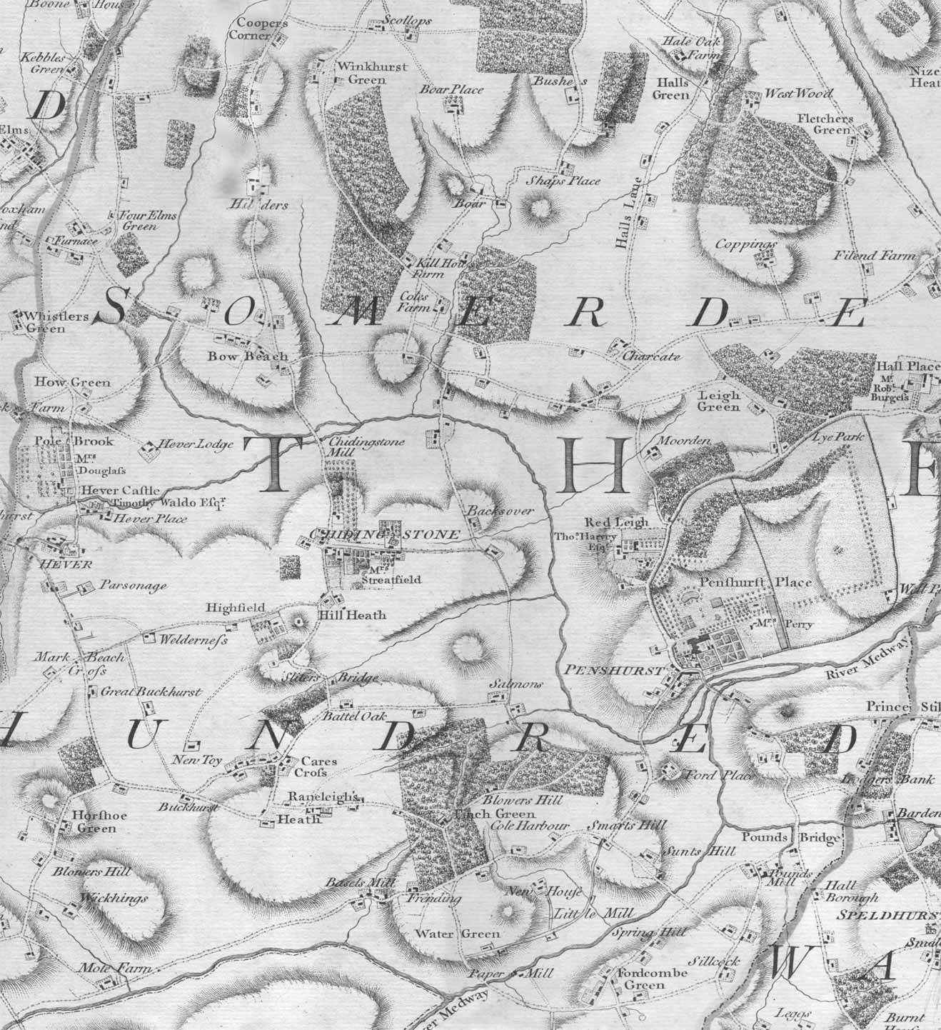
ANDREW, DRURY AND HERBERT'S MAP
A map of the whole of Kent was published by Andrew, Drury and Herbert in 1769. The scale was 2 inches to a mile and came in 24 sections.